
On 29 October 2018 Regional Economic Development Minister Shane Jones and Land Information Minister Eugenie Sage announced that up to $19 million co-funding from the Provincial Growth Fund (PGF) is available to help regions obtain a baseline elevation dataset, which will deliver enormous practical value and multiple uses over the coming decades to councils and regional industries.
Toitū Te Whenua is managing this initiative on behalf of the Ministry of Business, Innovation and Employment, and the participation of ten regional councils significantly expanded the availability of national LiDAR. The programme has delivered high accuracy 3D data for the coloured relief area shown below, and the national coverage is now over 80%.
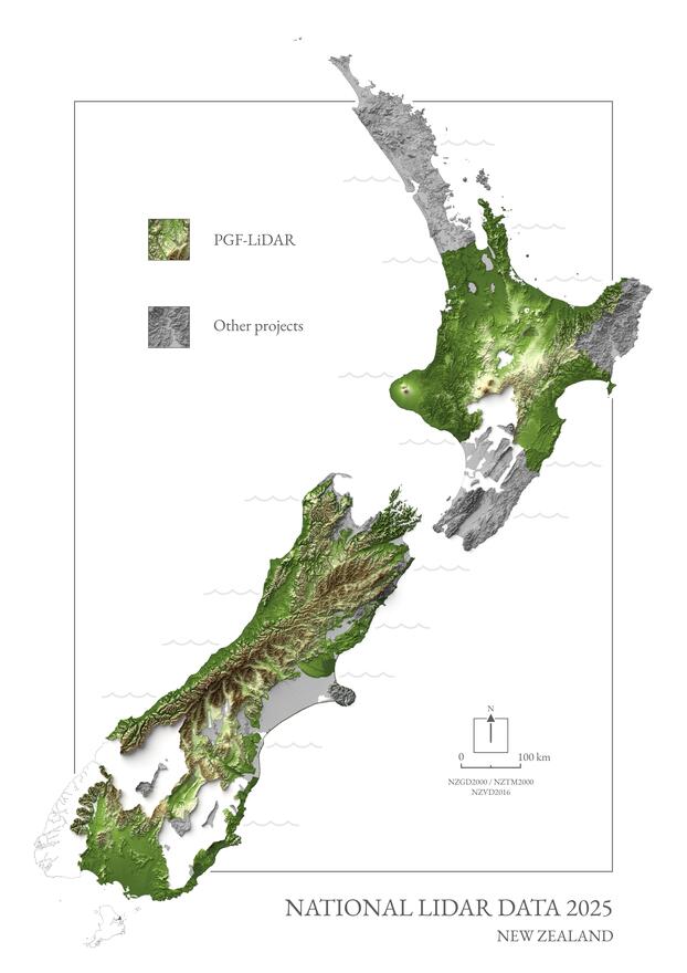

All data is available from the LINZ Data Service, except for the Whanganui River catchment which will be completed in 2025. The standard open-data products are a 1m gridded bare earth digital elevation model, a 1m gridded digital surface model, and the source data point cloud. For data access, see our page on elevation data.
The PGF-LiDAR programme has delivered high quality data to meet councils’ needs primarily for land use management and infrastructure development. The data is also widely re-used to benefit New Zealand. These benefits are summarised in the Post-Contract Outcome Report.