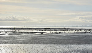
Photo Credit: Christopher Stephens, New Zealand Geographic Board
The Waihou River was and is very important to the local Hauraki hapū. In early times, it provided food, fresh water and transport. A literal translation of ‘Waihou’ is ‘the newly formed river’ – possibly a reference to the formation of Waihou after the diversion of the Waikato River which originally flowed through the Hauraki plains.
In November 1769, the HMB Endeavour entered the bay that the Waihou River empties into. Cook, Tahitian arioi Tupaia, and naturalists Joseph Banks and Daniel Solander set out in a small boat to explore the inlet and travelled up upstream. The river was surrounded by thick stands of bush, with the occasional Māori village. In his journal, Cook remarked that:
we had named this River the Thames on account of its bearing some resemblence to that River in england
Cook remarked the tidal flow was similar ‘12 or 14 miles’ up the New Zealand river as in the English Thames. Additionally, both rivers finish in a large inlet before entering the wider sea.
Cook labelled both the river and the inlet ‘River Thames’, as did the next couple of European surveyors. At some point, however, the inlet became known as the ‘Firth of Thames’. ‘Firth’ is a Scottish term for an inlet, primarily used on the east coast, but there are very few ‘firths’ outside of Scotland. It is probable that the name results from the voyage of Captain James Herd, of the New Zealand Company. Herd was from Scotland and spent a winter in the Firth of Thames in 1826. The first chart the firth appears on is JW Norrie’s ‘A New Chart of Part of The Pacific Ocean’ in 1829. Maps after this time use ‘Firth’ or ‘Frith’.
While the firth remained ‘Thames’ on maps, the river’s name varied. In 1947, a man from Paeroa asked the New Zealand Geographic Board (NZGB) to clarify which bit of the river was the ‘Waihou’. The NZGB secretary commented:
No rule seems to have been followed by later draughtsmen as various descriptions appear. On some maps ‘Waihou’ appears as the only name and on others ‘Thames’ only, although the majority of maps are marked ‘Thames or Waihou’. These names however always apply to the whole course of the river and not any particular portion thereof.
After some investigation, the river’s official name, from source to mouth, was officially assigned as ‘Waihou’ in 1948.
References
- NZ Gazetteer - Firth of Thames
- NZ Gazetteer - Waihou River
- Taimoana Tūroa, Te Takoto O te Whenua O Hauraki – Hauraki Landmarks, Reed, Auckland, 2000, p. 195
- Paul Monin, 'Hauraki–Coromandel region - Climate, plants and animals', Te Ara - the Encyclopedia of New Zealand
- James Cook, ’20 November 1769’, South Seas: Voyaging and Cross-Cultural Encounters in the Pacific (1760-1800)
- Hilda McDonnell, The Rosanna Settlers: with Captain Herd on the coast of New Zealand 1826-7, 2002
- PB Maling, Historic Charts and Maps of New Zealand 1642-1875, Caxton Press, Christchurch, 1999
- NZGB, Correspondence, 29 October 1947, Vol. 22, p. 220
- NZGB, Correspondence, 16 September 1948, Vol. 23, p. 250