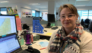
- Qualification and GIS component: BSc double major in Geography and Statistics, Postgraduate Diploma in Forensic Science, Postgraduate Certificate in GIS
- Tertiary Institute: BSc and PGDipForensic at University of Auckland, PGCertGIS at Victoria University of Wellington
- Secondary School and Year 13 subjects: Hillmorton High School – English, Statistics, Physics, Chemistry, Economics
Why did you choose to study GIS?
GIS is one of those things that I accidentally ‘fell’ into. I didn’t set out to gain qualifications in GIS, but I enrolled in an introductory course in second-year as part of my Geography major. I’m a bit of a tech nerd, really loved it, and from there I started looking at what other papers were on offer. I ended up completing my degree with a research project using GIS – creating a preliminary model for predicting where a hillside would fail during heavy rainfall events, based on a location in the Bay of Plenty. And that is kind of where it all began. I realised that I was super-fascinated with the visual display of spatial information and really intrigued by analysis done using that info. When I started my current role, my GIS gears were a little bit rusty, but it reminded me how much I enjoyed GIS and motivated me to keep developing my skills, prompting me to enrol in the PGCertGIS at VUW.
What are some of the benefits you’ve experienced from studying GIS?
A big one for me is realising that GIS extends beyond the software you use. I’ve been introduced to a lot of GIS concepts that are widely applicable. With my background in stats and forensic science, I can see how some of those concepts fit into those fields. It also seems kind of obvious, but GIS has taught me to think spatially almost automatically. When confronted with questions or problems, I think about how its spatial elements can be used to help provide an answer. This has been particularly useful as I work and study at the same time – quite often as I learn techniques I think about how they can be applied to my work. I work with a lot of people who use words for a living, so helping them to see how spatial representations of information can save a lot of words on a page is really satisfying.
How important is GIS for your existing and future career options, and why?
I’d say it’s fundamental! Without my experience and knowledge in GIS my current career pathway wouldn’t exist. As for my future career options, I think it provides a useful tie between my other qualifications. GIS knowledge and experience contains an abundance of translatable skills and you aren’t pigeon-holed into one specific application of GIS. I have seen applications in geology, physical geography, population health, business, travel and tourism, government, natural resources and culture. For someone who enjoys variety in my work, this is a big draw card.
What advice would you give to future students considering adding a GIS component to their studies?
Absolutely do it! It’s a skill that’s becoming a lot better understood and is much in demand. GIS is wanted as a facet to many different jobs, not just as a specified career. There is a shortage of geospatial skills In New Zealand – you would be adding a desirable skill to your portfolio. Everything happens somewhere so there is a spatial element to everything you can think of. I’ve seen first-hand how valuable and meaningful it can be to enable people to see things spatially – maps are super powerful resources! I would 100% recommend a GIS intro paper to anyone thinking about it.