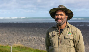
- Qualification and GIS component studying for: Postgraduate Diploma in Arts (GeoSpatial Science)
- Tertiary Institute: Massey University
Why have you chosen to study GIS?
I discovered GIS through my previous role with Core Education as a Learning with Digital Technologies facilitator in schools. At the time localised curriculum was a key focus and I began to explore basic mapping tools such as Google My Maps and Google Earth to help students to share about their cultural narratives through mapping their Pepeha to locate their maunga, awa, marae and other sites of interest.
My passion and interest in GIS was further enhanced through participating in two Indigenous Mapping Wānanga, helping to coordinate a virtual mapping field trip in Taranaki which I presented about at the Geo For Good User Summit at Google Outreach in San Francisco at the end of 2018. This was a huge buzz, providing a once in a lifetime opportunity to explore some amazing GIS tools and to meet like minded people involved in inspiring projects focussed on creating positive change for the planet and its people.
I recently started a new role with Te Kāhui o Taranaki trust as a member of the taiao team. Applying GIS tools to monitor the health of our awa, moana and whenua is a key part of our role. In order to grow my understanding of GIS fundamentals and application in the environmental space I chose to enroll in the distance learning course offered at Massey. This has allowed me to apply my new learning while I’m on the job and to share this new knowledge with my team and wider community.
How important is GIS for your future career options, and why?
I’ve started my GIS career later than most people probably have but I don’t see this as a disadvantage. My previous life experiences and vocational roles have provided a strong foundation for my current occupation and where I am heading in the future. This is possibly the final chapter of my career but GIS is like the great ocean of the Pacific and has plenty of opportunities on offer and my current goals are to explore more deeply into areas of cartography, field data capture, story telling, remote sensing technologies and spatial analysis.
How has studying GIS shaped your career goals?
My current focus is on learning as much as I can to develop and grow GIS capability in our iwi and hapū spaces. GIS is rapidly changing too, so it is important that we keep up to date with new developments in technology and bring our next generation of innovators aboard. One of my key roles then, is to encourage and support the next generation of rangatahi to come aboard the waka.
What advice would you give to future students considering adding a GIS component to their studies, especially students who may be older (possibly with children) and are changing career paths?
Firstly, if you are up for an adventure and a challenge then GIS is for you. Age is definitely not a barrier, I’ve had over 20 years in the education sector before I started my GIS journey. I have three tamariki and all of them have come alongside me at some point while I’m doing my mahi. My middle child has taken a particular interest in flying drones and enjoys coming out to the field with me. Perhaps this is a career pathway for him in the future.
I’m definitely not an academic but I am passionate and determined and enjoy the practical application of GIS in the taiao space. It can be technically challenging and comes with it’s frustrations but this is helpful for your personal and professional growth in the GIS field.
If you enjoy working with technology, like problem solving, connecting with people and the outdoors this is a great kaupapa to be part of. Most importantly however, you need to maintain a healthy balance with your mental and physical wellbeing because you tend to spend long hours looking at screens. I’m still getting there with that goal.
If you are interested in GIS attend a workshop either face to face or virtual.Through these kaupapa you have the opportunity to connect with GIS professionals and like minded people. This is how I started on my journey.
If you are studying GIS via distance learning what tips can you give about studying GIS this way?
Don’t be afraid to contact your lecturers and ask for help. They are more than willing to help you. Connect with other students on your course and join many of the online forums and courses offered on YouTube by Esri, QGIS and Google. Also go to Facebook to find support from GIS 4 Māori and Ngā Poutama Matawhenua - Practical Māori GIS Mapping offered through LINZ. These are great places to meet other students and whānau interested in GIS.
Last year you applied successfully for a LINZ external tertiary GIS scholarship. What difference has this made to you and your GIS study courses?
I was over the moon and grateful to LINZ when I received this scholarship. In many ways it provided me with the much needed endorsement to return to formal study and pursue a career in GIS. This scholarship definitely helps to keep me focussed on my studies providing an incentive to do my very best. At times I have found some of the projects a real challenge and this scholarship has given me the motivation to get up, carry on and complete each task. E kore e mutu ngā mihi ki a koutou, Toitū Te Whenua!