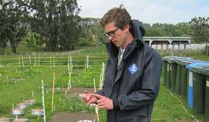
- Qualification and GIS component: MSc (Conservation Biology): GIS-intensive research thesis; special topic in GIS at 400 level.
- BSc (Geography and Environmental Studies): two undergraduate GIS papers.
- Tertiary Institute: Victoria University of Wellington
Why did you choose to study GIS?
I first took a paper in GIS as an elective for my geography/environmental studies degree. I didn’t know much about geospatial at that time, but I’d always loved maps so I followed a whim. During the course of that paper I was introduced to the power of geospatial for solving scientific research questions. This led to a Master of Science degree where I applied spatial techniques to quantitative ecology. I enjoy the problem-solving aspect of GIS, which in a research environment often requires innovating new approaches.
What are some of the benefits you’ve experienced from studying GIS?
GIS has been central to both my academic and professional pursuits. The sorts of questions I’m interested in cannot be addressed without GIS. This is equally true for my current focus in agricultural science as it was for my previous work in spatial ecology. GIS has also been a gateway into computer programming, which is an increasingly useful skill in research. I also use GIS quite a lot outside of work, mostly for planning adventures in the great outdoors.
How important is GIS for your existing and future career options, and why?
As I work in spatial science it’s central. The fact that GIS is used in such a wide range of applications gives some flexibility for future career moves, either in a purely geospatial discipline or as a complementary skill in another field.
What advice would you give to future students considering adding a GIS component to their studies?
GIS can be a career in itself but it can also be a useful tool in countless other fields within science, policy, conservation, business, IT, defence and others. The list is long, and it’s growing as more come to realise the power of spatial information. GIS is a good tool to have on your belt even if you don’t plan to be a geospatial professional.
Also, don’t be discouraged if you don’t ‘click’ with it right away. Having studied and tutored GIS I can attest that it’s often a steep learning curve at first. But once you gain some familiarity with it you start to have a lot of fun.