About LINZ Basemaps
LINZ Basemaps use authoritative data from LINZ and other open data sources and are free to use under an open licence.
You can use our APIs to stream map tiles direct from the cloud, giving you both quality and performance. Our APIs work with any mapping app: GIS, web or mobile.
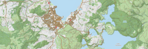
Topographic Basemap

A modern take on the classic LINZ Topo50 map.
This general-purpose map displays New Zealand’s built and natural landscape. It features the latest road, address and property data and uses relief-shading to bring the map to life.
The Basemap is a vector tile service. It works at all scales, from a national to property level.
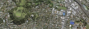
Aerial Imagery Basemap

This high-resolution aerial imagery basemap displays a nationwide view of New Zealand, allowing users to zoom in to see individual buildings.
The latest imagery, down to 5cm in urban areas and 10m satellite imagery, provides coverage of mainland New Zealand, the Chathams and offshore islands.
Basemaps in 3D
Our high-resolution aerial imagery basemap can now display New Zealand in 3D.
Users are able to view contours, hill shades and slopes, to get a better understanding of terrain across the country.
Example of aerial imagery basemaps in 3D
Guidance
View guidance to help you build your own New Zealand-centric maps for mobile, web and GIS apps - LINZ Basemaps guide.