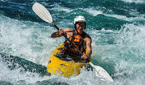
- Employer: Summer Intern of LINZ and Watercare
- Qualification and GIS component: BSc Double Major in Geography and Computer Science, pursuing an honours which focuses on GIS.
- Tertiary Institute: University of Auckland
Why did you choose to study GIS?
At the beginning it was more or less a field that I fell into as I pursued my interests. For me maps have always been fascinating as a story about both the landscape and how people interact and interpret it, and I find that my passion lies in the creation of things for use by other people wherein programming greatly appealed to me because of this. I ended up combining geography and computer science as a degree, and then discovered that GIS existed as a happy accident to which I could apply both parts of my degree.
What are some of the benefits you’ve experienced from studying GIS?
The pretty immediate effect was realising just how much data there is available and the truly immense amount of uses it has. I keep finding that from modelling landslides, to shoreline detection through remote sensing there are seemingly infinite uses for almost any imagery and spatial data you can get your hands on. What is even more surprising is that people only seem to realise after you make something and show it to them.
It also really opens up your mind to critical/outside the box thinking. When undertaking any project there are always a plethora of challenges and problems that arise, from sourcing data to having to creating your own scripts to solve a problem that has little documentation or knowledge available. The avenues to solutions, as well as the multitude of different applications you could be working on makes it appear that you can never run out of things to do or end up being bored of your work.
How important is GIS for your existing and future career options, and why?
It is what I am aiming to pursue as a career, so it is of the utmost importance. What is encouraging is that more and more organisations are realising the importance of the huge amounts of data that they have, and that leveraging the spatial aspect is becoming more of a priority.
It really is a niche industry that has the opportunity to grow at an incredible rate. I count myself lucky to stumble upon it at university as it is likely to become an incredibly lucrative field to work in.
What advice would you give to future students considering adding a GIS component to their studies?
You can’t go wrong with it really, even if you don’t want to be in a dedicated GIS job you will find it incredibly useful. Whether you are chasing environmental management, geology, engineering, or statistics you will find that you will probably end up using GIS software. As I am writing this now I was just talking to a guy doing his honours in geophysics. His very words were “I wish they told us that you were going to be using ArcMap in the future anyway, so you may as well learn to use it now rather than later” in regards to his undergraduate study.
You have done some Computer Science/IT studies – how important do you think the link between Geographic Information Science (GIS) and Computer Science/IT is?
I think it really is critical to try at make an effort to understand the basics of programming. You don’t have to be an expert but it really is a huge boost to your employability just to say you have an understanding of something like the Python programming language, which underpins ArcMap and QGIS.
GIS really comes down to using software to manipulate data, just being an advanced ArcMap user isn’t going to be enough. Increasingly it seems graduates are coming out who can operate something like ArcMap, and to stand out from everyone else and say that you can write a plug-in or create a useful script in ArcPy would get you in the door. I think competition is going to get tougher for graduates, as more people will be joining the field, but intern and graduate positions are going to be much slower to increase. You don’t need a Computer Science degree, but I can’t recommend enough trying to learn the basics of something like Python as it will make a world of difference.