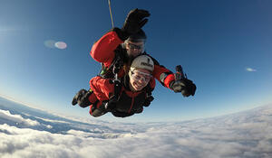
- Qualification and Remote Sensing component studying for: Bachelor of Science with a major in Earth Science and a minor in Geography, now pursuing a Master of Science in Remote Sensing
- Tertiary Institute: Massey University
Why have you chosen to study Remote Sensing?
When I began my Bachelor Degree majoring in Earth Science I had never even heard of Remote Sensing. One of the compulsory courses of my degree was a GIS and Remote Sensing paper and another one was Advanced Remote Sensing. I found both papers really enjoyable and they were probably my favourite aspect of the whole degree. I have chosen to continue studying Remote Sensing at the postgraduate level so that I can continue to pursue my interest in the subject as well as to improve my skills as much as I am able to so that I can then pursue it as a career.
How important is Remote Sensing/GIS for your future career options, and why?
Remote Sensing very important for my future career options. This is because I would like to pursue a career based around Remote Sensing and because it is such a specific area of study this only makes it more important. I have a passion for the environment so I would like to incorporate this into my future career as well. I believe the skills I have achieved during my studies will allow me to enter a career in which I can use my knowledge of Remote Sensing to better the environment. Even less specifically than that, I know that with my skills in Remote Sensing I will have many career options that I will be able to pursue and that I will find enjoyable.
How has studying Remote Sensing shaped your career goals?
Until I realised how much I enjoyed Remote Sensing I wasn’t sure what I wanted to do once I had completed my Bachelor Degree. I decided to continue into Postgraduate study because I believe it will help me to achieve my career aspirations of working somewhere where I use Remote Sensing. I am still not sure of what kind of “job” I specifically want once I complete my studies, but I do now know that I would like it to involve Remote Sensing in a way that I am able to pursue my passion for the environment.
What advice would you give to future students considering adding a Remote Sensing/GIS component to their studies?
I would suggest to future students that they definitely give Remote Sensing/GIS a go. Most people I talk to do not even know what Remote Sensing or GIS is so I think it would be great if more people got involved with it. It teaches you a range of skills which can be transferred into so many different areas of study or work. I think a lot of companies are starting to see the value and importance of Remote Sensing/GIS software so it would be good to learn about it now to put you ahead in the future.