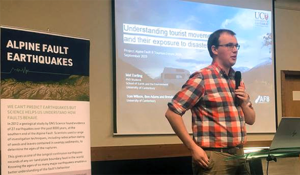
- Qualifications: Bachelors of Science (Double Major: Geology, Geography) from University of Otago, Master of Disaster Risk and Resilience from the University of Canterbury PhD Candidate
Please can you briefly describe your research area and question?
My research area is focused on understanding how transient populations (tourists, seasonal workers) are exposed to disaster risk. We are drawing from a variety of case studies, but in particular we are interested in how they are exposed to a potential large earthquake generated on the Alpine Fault. To do this, we are using geospatial methods to understand how they move through the country and thus exposed to exposed to disaster risk.
How do you hope your research will help New Zealand manage emergencies?
Through an accurate understanding of how people move through New Zealand, through space and time, we can start to make some really good disaster risk decisions. These sorts of decisions will inform things like the provision of emergency supplies, appropriate positioning of visitor assets or evacuation plans.
What are some examples of who might use your research, where and when?
My research is being developed alongside key decision makers in civil defence emergency management and tourism/primary industries. Through this ongoing engagement I am aiming to make something useful to support them. We recognise this may be in a variety of contexts, including before a disaster (i.e. planning), the lead up to an foreseeable disaster or understanding the changing risk dynamics following a major disaster.
What were some of the technical challenges in your research?
Data. There is no shortage of data sources, and every meeting I go to, someone else has another data source I hadn’t considered! One of the key challenges is recognising the most appropriate data source(s) to turn into insight. This of course depends on the problem which the decision maker is trying to solve. I.e. in the heat of the moment, a really ‘rough and ready’ data source may be OK for a decision maker to build a quick picture, while in other situations a really accurate understanding is important.
What are some highlights for you?
My research area is emerging as high priority for New Zealand in order to effectively reduce disaster risk of our communities. It has been awesome to get around the country and work with decision makers to understand the scale of this challenge in a variety of contexts. It is also really rewarding to be part of a bigger program of research with the fundamental aim of improving New Zealand’s collective resilience.
How has the LINZ GIS scholarship helped you?
I am super grateful for the support received from LINZ towards my research. Equally I have really appreciated the opportunity to work closely with LINZ’s resilience team as a key part of my research.
Can you see other opportunities for further research?
Absolutely – there is a lot of research which is being undertaken across the Resilience to Natures Challenge, QuakeCoRE and Project Alpine Fault 8 research platforms. My work is only a small part of this, and I’d certainly encourage others to think about getting involved in tackling some of this large national challenges.
Would you encourage others to enter into this field? Why?
Geospatial, and GIS provides us with some powerful tools to understand how the world is related and interrogate spatial relationships in ways were not previously possible. It can provide us with key insights into disaster risk, including exposure, hazards and vulnerability. It equally can be used to understand effectiveness of different risk reduction techniques. I would really encourage those who enjoy using to geospatial tools to consider entering this field - I think using these GIS to solve such global problems is pretty dam exciting!