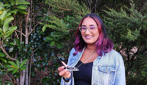
- Qualification and GIS component studying for: Bachelor of Advanced Science, Specialising in Geospatial Science
- Tertiary Institute: Auckland University of Technology (AUT)
- What Year 13 school subjects did you take: English, Statistics, Biology, Chemistry and Geography
- What Secondary School did you attend: Avondale College
Why have you chosen to study GIS?
I was at a complete loss when it came to deciding what I wanted to study further and pursue as a career. I knew that I really enjoyed geography and the science subjects at school and wanted to continue my studies along those lines. I ended up initially deciding to study a Bachelor of Science double majoring in Geospatial Science and Environmental Science. When I started my degree, I did not have a complete understanding of what GIS was, but I felt that this pathway would be suitable as it would incorporate mapping, science, and research all into one degree.
As I progressed through my degree and started understanding what GIS is, I switched my study pathway into a Bachelor of Advanced Science specialising in Geospatial Science. I chose to study GIS more exclusively as I love the creative aspects of the field. Being able to create visual outputs and use my creativity in conjunction with science and research was something I really enjoyed doing. I also found working with spatial data very exciting which has made my studies lot more pleasant as I am genuinely interested and engaged with the data and assignments.
How important is GIS for your future career options, and why?
Pursuing a career that enables me to take raw data and create a visual output that is creative and informative is something I really value. Working with GIS will provide me with opportunities to be able to do this so ultimately working within the GIS industry is my career goal. GIS can be used across many different professions in many different forms and applications. Currently, I am particularly interested in working in the fields of geohazards and environmental sustainability. I think using GIS innovation in these fields is important and would be extremely beneficial as GIS analyses can extract so much new information from raw data and provide an easy form of data presentation that can make important data accessible to the wider public.
How has studying GIS shaped your career goals?
Immensely. As a first year uni student I had no clear career in mind but as I progressed through the undergraduate part of my degree and started learning more about GIS, I realised it was something I really enjoyed and wanted to pursue. Through my studies, I was able to narrow down my list of potential careers to specifically a career within the GIS field.
What advice would you give to future students considering adding a GIS component to their studies?
I would definitely encourage future students to consider adding a GIS component to their studies. I feel that the demand for GIS analyses is getting larger as the industry grows and more people become aware of the capabilities and results GIS can produce. It is a skill that employers would value and therefore having GIS in your skillset would be extremely beneficial and would make new graduates more employable.
GIS is also such a versatile skill to have, there is so many applications for it in many different industries. Even if you do have a change of heart in what specific field you want to enter in as a career, studying GIS would not be waste of time as it can be applied in so many different forms and fields. GIS can be used everywhere from engineering, environmental, geology, urban planning, historical, the list goes on.
Another piece of advice I would offer to future students would be to not get scared by the idea of GIS. At first it was quite overwhelming getting thrown into the middle of all this software that I had never worked with or heard of before. But if you are patient, and take your time learning and understanding the basics, you will find that once you know your way around the tools everything will feel a lot easier, and you will enjoy it too.
Last year you applied successfully for a LINZ external tertiary GIS scholarship. What difference has this made to you and your GIS study courses?
Receiving the LINZ tertiary scholarship was a major booster in motivating me to continue studying at a postgraduate level. At the end of last year, I had completed the 3 year long undergraduate section of my 4-year degree. I was over studying and keen on getting out into the industry and putting my foot in the door but receiving this scholarship really encouraged me to keep on grinding and graduate this year with Honours. I am so glad I continued studying at postgraduate level as I am expanding my skillset and knowledge and will be much better equipped to enter the industry. Thank you LINZ for the motivation!