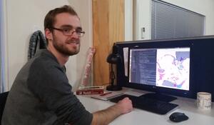
- Qualification and GIS component: Master of Geographic Information Science
- Tertiary Institute: Victoria University of Wellington
Why did you choose to study GIS?
Generally, geography appeals to me. As one my college teachers said, "Geography is the study of everything". I feel this really applies to GIS as a sub-discipline of geography. It runs the gamut from computer science, mathematics and natural language processing to environmental sensors, design (cartography) and user experience. To be effective in GIS, you first need to be happy being a generalist, and willing to pick up new skills as they are required. I think I would quickly lose interest if GIS weren't such a diverse concept.
What are some of the benefits you’ve experienced from studying GIS?
The variety of applications you can work on, because the skills are so transferable. I've worked in an econometric research institute, and now I work amongst oceanographers. Almost all data is spatial, and therefore you can find opportunities in any area where data is central.
How important is GIS for your existing and future career options, and why?
It's in my job title, so without it I don't know what I'd be doing. I'd say that's pretty important! Because many organisations are only just discovering the spatial element to their data, and because we are collecting new sources of spatial information every day, I don't see the industry doing anything but going from strength to strength.
What advice would you give to future students considering adding a GIS component to their studies?
I think there are fundamentally two ways to approach studying GIS. Firstly, from a domain-specific approach where you focus on a domain you're interested in (oceanography, biology, transportation, economics, journalism, whatever) and gain the ability to work with the spatial aspects within those domains as a secondary pursuit.
The other is to really double down on the bits that are particular to GIS in any area, such as spatial databases, programming, cartography, spatial statistics, photogrammetry and image analysis to name a few. Both options are great, and your decision should come down to how much you would prefer working across different domains as a GIS specialist, or being a subject-matter expert with very marketable GIS skills.
My other piece of advice is to those already studying GIS, and it is to always keep in mind that GIS is not merely a piece of software installed on your computer, but the underlying concepts of spatial relationships: that is, geography. Go well beyond button pushing; avoid vendor lock-in; think critically about your process; and remain scientific by ensuring that your results are replicable.