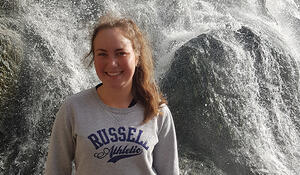
- Qualification and Remote Sensing component studying for: BSc Double Major in Earth Science and Geography, pursuing a Masters in Remote Sensing
- Tertiary Institute: Massey University, Turitea Campus, Palmerston North
Why have you chosen to study Remote Sensing?
I was initially pursuing a different path at university until I discovered Earth Science and my love for all things included in the degree. I had always had an interest in Geography so decided to include them both in my BSc. I was pleased when it came to the GIS and Remote Sensing paper as I found a connection to the processes of making informative maps and analysing images. I am now learning about the programming of Remote Sensing which I find so interesting and challenging.
How important is Remote Sensing/GIS for your future career options, and why?
I strongly believe that both GIS and Remote Sensing have everyday uses and can help across many professions. It is a way of displaying data informatively and can be made specific to any study. There is a world of information out there which can be easily accessible and applied. It is always so fascinating to me what I can do with this information and pursuing a career where I can learn more is a dream for me.
How has studying Remote Sensing shaped your career goals?
It has given me a career goal that I did not initially have. For so long I was quite lost and did not know what I wanted to pursue as a career. Now I know I want a career in Remote Sensing.
What advice would you give to future students considering adding a Remote Sensing/GIS component to their studies?
My best advice is to have patience. There are a lot of moments where you won’t get the result you are after straight away. Having the ability to think of new ways to get around a problem is very important. Sticking with it will be so rewarding and there is always a category for you in GIS and Remote Sensing.